Bastnäsite Detection
Explore critical resources like rare earth elements and lithium - key for renewable energy and national security.
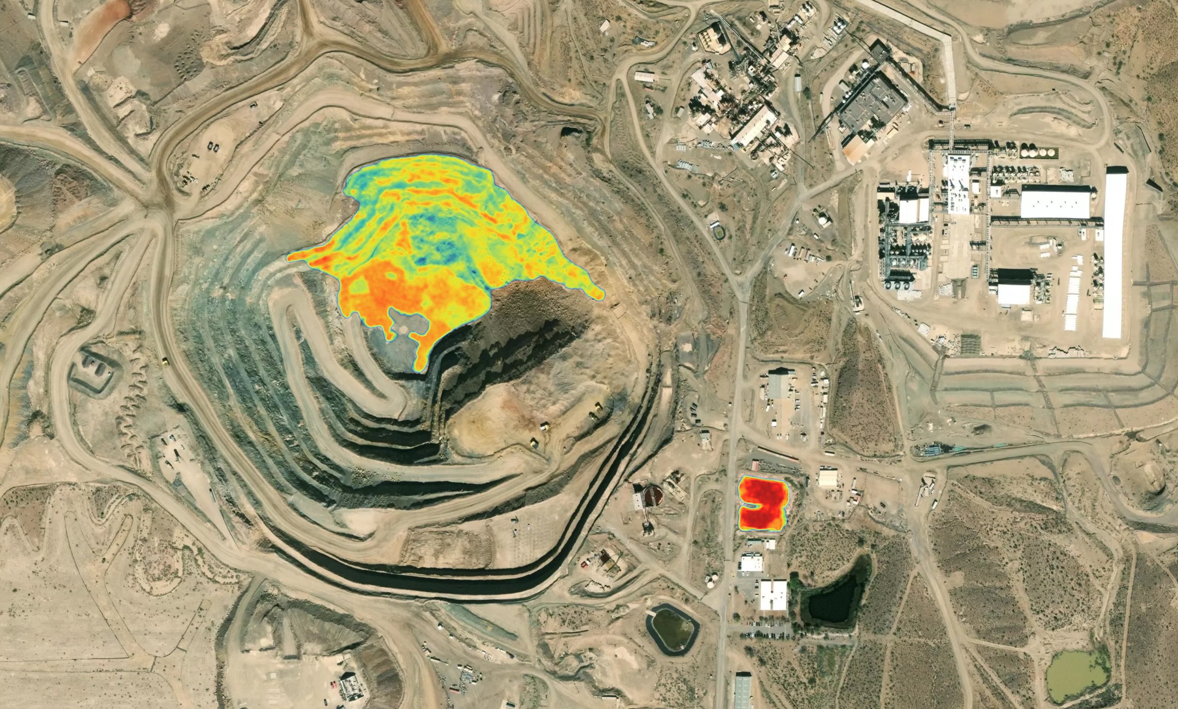
DOY 2024-289
T13:21:10 Local Time
The Gap
Exploration is resource intensive and today’s satellite data lack the technology to detect and quantify mineral assemblages of interest.
The Solution
Direct detection of mineral abundances and uncertainties to guide mine operations and find untapped resources anywhere on Earth.
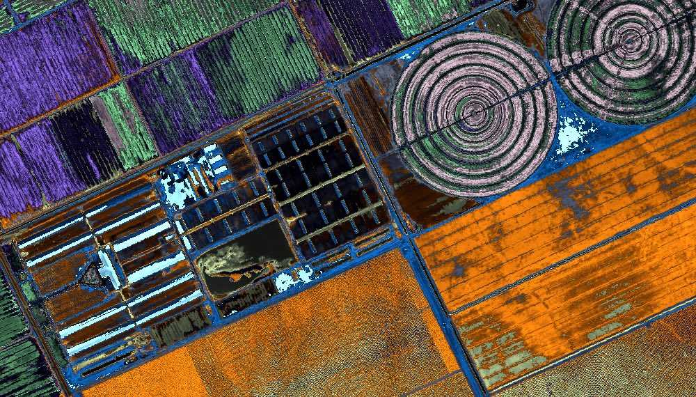
Precision Farming
Detect diseases, nutrient deficiencies, and other costly issues early to minimize losses and reduce manual workloads.
DOY 2023-353
T13:23:53 Local Time
The Gap
Today’s satellites offer low-resolution multispectral indices that are symptomatic of past issues and don’t drive meaningful intervention.
The Solution
Direct quantification of soil and plant nutrients, early disease detection, and more at the individual plant level to drive specific intervention.
Nitrogen Dioxide (NO2) Detection
Accurately track gases and pollutants like methane and sulfur dioxide to monitor emissions, industrial activity, air quality, and environmental compliance.
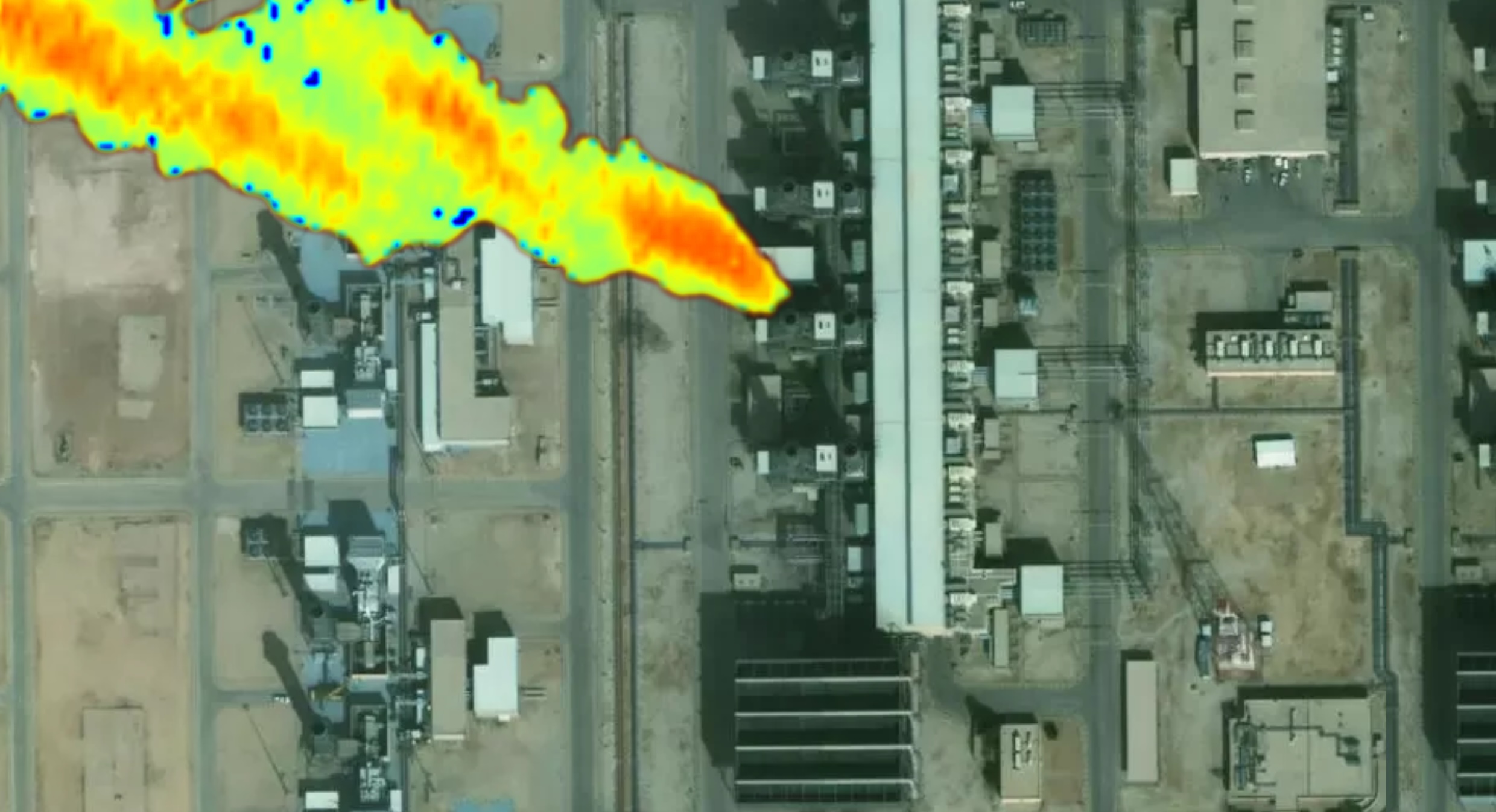
DOY 2024-147
T13:19:08 Local Time
The Gap
Current systems lack the capacity, sensitivity, and resolution to detect small but important emissions and trace their sources effectively.
The Solution
Global emissions monitoring of these gases and other volatiles with the lowest detection limits ever from space (e.g., <50 kg/hour for methane), with resolutions that enable source identification.
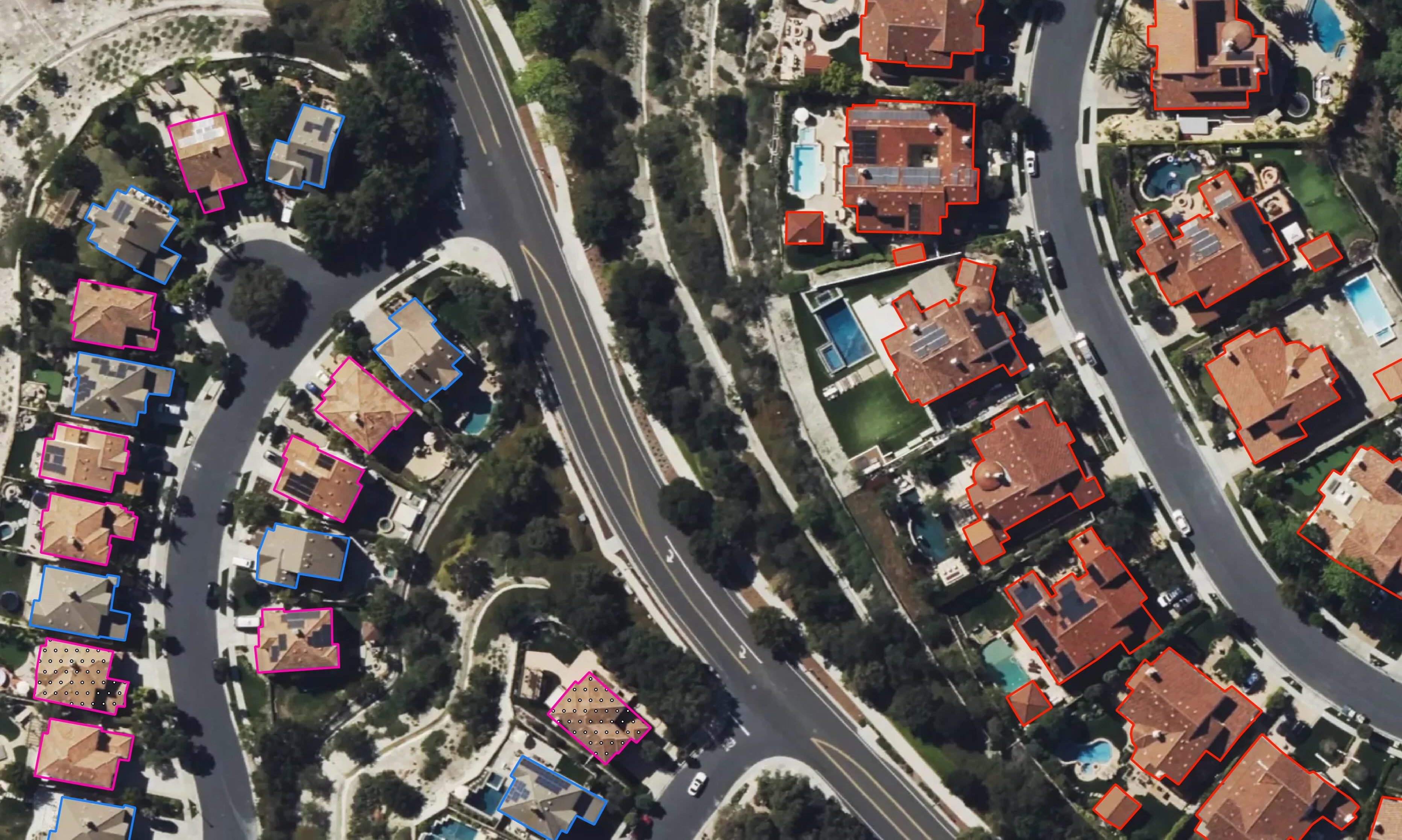
Risk Assessment
Accurately geolocated metrics on properties for risk assessment during underwriting.
DOY 2024-186
T13:22:35 Local Time
The Gap
Today’s sensors don’t provide adequate information about roof quality, vegetation, occupancy, and more for underwriting and RCV models.
The Solution
Direct measurement of roof material and quality, vegetation classification and health, occupancy, and more – significant improvements to property risk, wildfire, and flood models.
Next-Gen ISR
Directly measure composition, shape, and temperature globally with extreme resolution and rapid revisits to unlock completely new ISR capabilities.
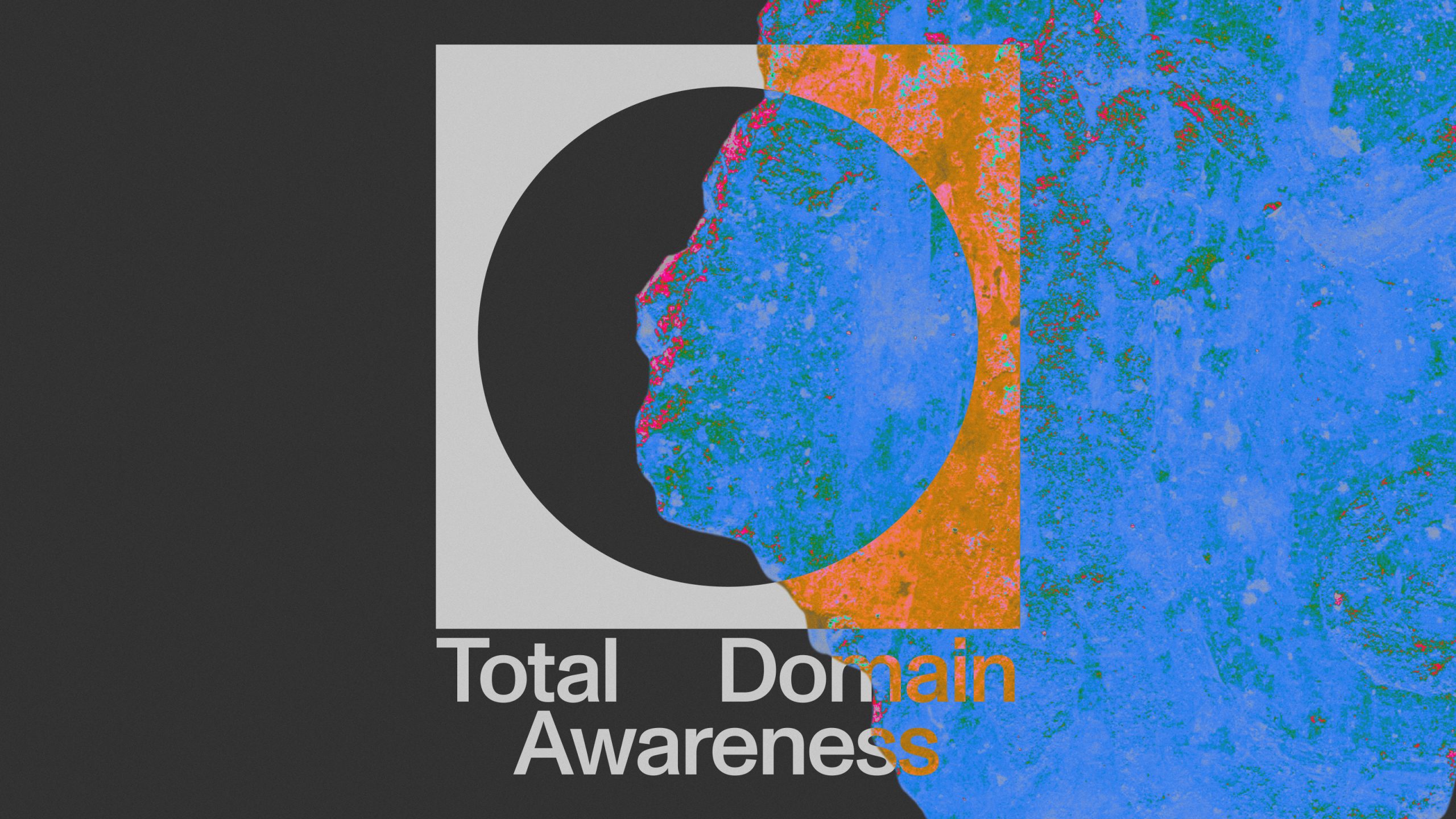
The Gap
Today’s sensors only measure the shape of objects, missing information and activities critical to warfighters.
The Solution
We see things nobody else can see. Contact us to learn more about how we can become your mission partner.
Emerging Capabilities
Every image Matter captures will have real information on shape, composition, and temperature - everywhere with extreme resolution.
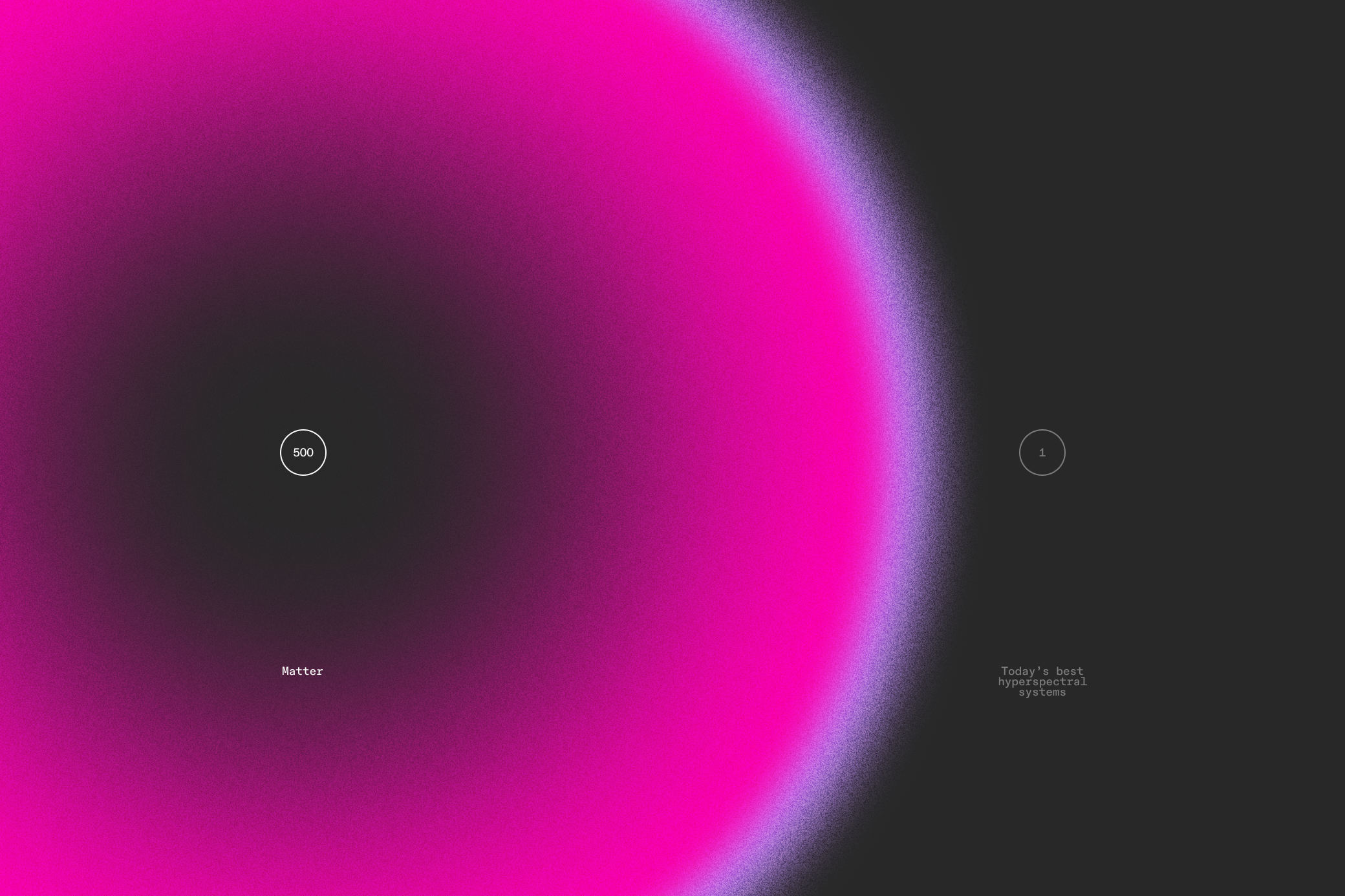
Information Density Comparison
The Gap
Measuring light from ultraviolet to thermal infrared with the highest spatial and spectral resolution, Matter unlocks a new world of unseen information and untouched applications.
The Solution
Nothing like it has been done before.